

1) Land & Property Information
Panoramic provides interoperable, scalable, and flexible Land Information Management (LIM) solutions and services to the federal and state governments, title and credit services industry, LIM professionals and governments use Panaromic's services for land use planning, land records management and administration, property convincing and transactions, and implementation of land policy & reforms.

Creation of large, complex geospatial databases for land registration, cadastre and land-use planning Development and maintenance of land information systems and solutions for agriculture farm mapping subsidies Mapping of habitats, environment, waste disposal, and historic land information essential for environment analysis Manual flood determination and flood mapping for identification of flood indentation zones.
2) GIS Data Conversion& Migration
Panaromic specializes in the data conversion (digitization) of Parcel mapping, Municipal GIS data conversion, sanitary sewer, storm water, and electrical utility systems, and street centerline data.
Our team can be easily dizitized and migrated to other GIS platforms such as ESRI, MicroStation and AutoCAD. Data can be delivered in formats suitable for direct use in GIS software, and/or in popular interchange formats for exchange with other entities.
As part of our quality assurance/quality control (QA/QC) program, we utilize a combination of manual and automated validation techniques to ensure the digital data layers meet national mapping standards for horizontal accuracy and attribute values.
- Parcel Mapping
- Electrical Facility Migration
- Cadastre and Land Records GIS Mapping
- Impervious Surface Mapping
- Property Assessment Building Capture
- Street Centerline Mapping
- CAD - Geo database Migration
The cadastral or parcel mapping process begins with extensive research drawing on source documents, which might include tax records, legal descriptions, subdivision plats, surveys or deeds. Geographic information is compiled and reconciled against precision aerial photography, and parcel identification numbers applied. Quality control is stressed throughout the database development process.
Pre process:
This process is followed to understand the completeness and condition of the inputs and help smooth flow for all subsequent activities.
Geo referencing:
Annotation representing the various information like Block, section, dimension and other Details are available at local coordinates whereas they need to be lined up on to their relevant Parcel or blocks or sections.
Creation of Parcel lines:
Annotation values such as lot dimensions, sub division names and block numbers are transferred as attribute to corresponding line features where these attributes are stored and maintained in CAD environment.
Creation of Boundaries:
Boundaries of Subdivision and Blocks are identified and generated using client provided Shape files. Along with these boundaries Historic lot lines and Land Hooks and Easements will be extracted.
Attribute transfer:
Attributes are transferred to all boundary and line features using the annotation values, which are provided, in the DGN files.
Edge match:
All drawing files are inserted into single file and edge matched to make seamless data of Existing features. Topology checks would be done on the seamless data.
Quality Control:
- Integrity of the digital file, including
- Data Capture consistency
- Layer convention
- Check for correctness of dimensions
Graphic data
- Correctness
- Completeness
- Topology
- Attributes Information
- Completeness
- Correctness
General
- File formats
- Data Corruption
Our QA and Acceptance Criteria
Quality assurance is the process of providing adequate confidence that the final Product optimally fulfills the intended purpose through rigorous checking of the Final product.
The QA process will review the following items:
- Adherence to all database attribute design and output format
- Correct entry of all feature attribute data
- Correct spatial position of each feature
- Completeness of all available features and attributes
- Data would be checked to ensure there is topological accuracy
3) Photogrammetry & LiDAR Processing

Photogrammetry Services
Currently our services include aerial triangulation, planimetric data collection, DEM and Contour generation, mosaicing and orthophoto production.
We employ cutting-edge photogrammetric tools for image analysis and presentation including analytical instruments and workstations to process collected data and deliver mapping products customized to your output formats.
We can provide a complete Aerial Triangulation (AT) including Block set - up, Bridging & Bundle Adjustment. Output can be provided in all the standard formats.
3D Topographic collection, Contours and spot heights can be precisely extracted. Output can be supplied in ASCII or Vector formats.
We are specializes with LiDAR data Processing and other Aerotriangulation, Orthophoto,Photogrammetry capabilities with latest LiDAR processing software and advanced Photogrammetry softcopy workstations.
Panaromic's LiDAR/ Photogrammetric services meet the international standards for aerial- triangulation adjustments, DEM/ DTM collection, plannimetric mapping, topographic mapping and orthophoto rectification. We have executed LiDAR Processing based on FEMA standards.
The LiDAR service includes:
Altimetric LiDAR (Light Detection and Ranging) provides accurate topographic data at high speed. This technology offers several advantages over the conventional methods of topographic data collection viz. higher density, higher accuracy, less time for data collection and processing, mostly automatic system, weather and light independence, minimum ground control required, and data being available in digital format right at beginning.
Due to these characteristics, LiDAR is complementing conventional techniques in some applications while completely replacing them in several others. Various applications where LiDAR data are being used are flood hazard zoning, improved flood modeling, coastal erosion modeling and monitoring, bathymetry, geomorphology, glacier and avalanche studies, forest biomass mapping and forest DEM (Digital Elevation Model) generation, route/corridor mapping and monitoring, cellular network planning, As-built Modeling etc.
The typical characteristics of LiDAR have also resulted in several applications which were not deemed feasible hitherto with the conventional techniques viz. mapping of transmission lines and adjoining corridor, change detection to assess damages (e.g. in buildings) after a disaster.
Airborne Laser Terrain Mapping:
Panaromic offers cost effective and consistent quality LiDAR services with international standard. Following are the services offered:
- Flight Line Adjustments
- Bare earth Extraction
- Building Extractions
- Contour Generation
- Advanced as-built 3D Modeling
- Planimetric Mapping
Mobile/Fixed Terrestrial LiDAR:
Panaromic is having wide ranging Expertise in Processing Terrestrial LiDAR data for As Built Modeling and Extraction of Value added products. We have pioneered in the Integration of Airborne and Terrestrial LiDAR data for Extracting High-resolution Virtual Reality Content
Expertise:- Extraction of Corridor Assets
- Detailed 3D Planimetry
- 3D Building Restitution
- Profiling and Volumetry of Mine sights.
- High resolution As Built Models of Structres/Plants
- High Quality Walk throughs and Fly throughs
4) Image Processing& Remote Sensing

Image processing and Remote sensing are critical components to all of our planning and environmental assessment projects. Panoramic uses revolutionary satellite technology and advanced image processing tools.
We have extensive expertise in satellite image interpretation and processing, having worked with most of the available satellite data products, including IKONOS, SPOT, PAN, IRS, Landsat.
Our Remote Sensing services include:
- Land use / Land cover Mapping
- Environmental applications
- High - resolution urban mapping
- Forest Mapping
- Snow and glacier mapping DEM/DTM
- Natural resource mapping
- Telecom
- Watershed Management
- Utility planning
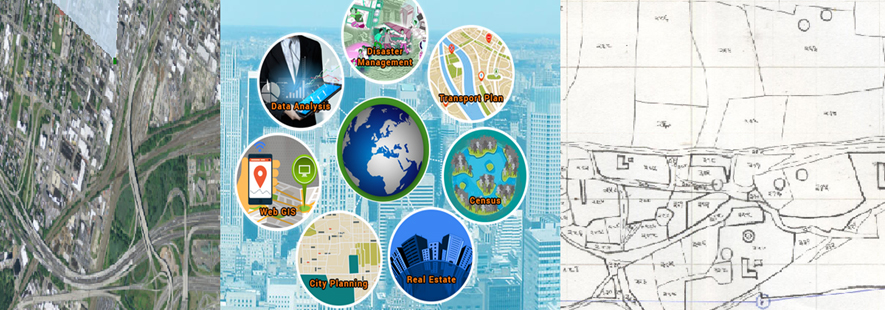
5) Enterprise GIS

GIS is taking industries by storm and is poised to transform them. For too long, many enterprises have been data rich but information poor. Now, through advances in GIS and other technology areas, this era is ending. In its place we see the emergence of GIS as a solution to providing meaningful business intelligence to management and accurate product and marketing information to clients and customers. GIS technology is fast becoming one of the linchpins of an enterprise's command center.
In the current competitive IT age, corporate organizations have to transform mainframe and client/server architecture systems to scalable and distributed internet-based network of systems. Enterprise system conception, development, integration, and support are the constant needs of any smart organization to exploit technology and tools to the full advantage reaching to its business performance and growth.
Our database design service provides an opportunity to leverage our specialist knowledge and experience of contemporary database theory to design databases that are highly responsive to each organization's needs and fully integrated with its business or enterprise applications and internal and external third-party systems.
Our application design service takes the specified requirements and from these defines the software architecture, components, modules, and interfaces necessary to deliver the agreed requirements.
Our methodology for workflow integration of GIS solutions with other business or IT systems within the Enterprise is increasingly based around the evolving standards of Services-Oriented Architecture (SOA) and web services and messaging
Strengths to meet your enterprise integration needs...
- Technology Expertise
- Cross-platform Experience
- Application domain Expertise
- Global Enterprise Partners
- Quality and Process Focus
GIS integrated enterprise system brings GIS technology to core enterprise systems, providing a lasting solution to corporate GIS needs of your organization. Under any enterprise system, geo-spatial data integration expands the scope of decision support and analysis capabilities.
In order to provide business intelligence and knowledge-based enterprise system through GIS technology, tools and solutions, we offer our services from needs assessment to deployment and support, building a high-end GIS-integrated enterprise system with data security, consistency and non redundancy of data and applications.
We offer needs assessment, requirements analysis, GIS-based system architecture, data warehouse and system design, system integration, deployment and post-deployment end-user support to maintain value of the enterprise system.
6) SAP - GIS Integration

Panaromic has broadest domain expertise in Electric, Water & Gas.
Panaromic is a services provider with a specific focus on the SAP for Utilities Industry. Our SAP development specialists utilize the most pertinent software innovations to provide Advance Business Application Programming (ABAP) solutions and highly effective web technology, SAP CRM (Utilities).